Before You Go
Aba Tibetan and Qiang Autonomous Prefecture is too large and varied to treat as one quick loop. Plan it as separate corridors: Jiuzhaigou and Huanglong; Mount Siguniang; Ruoergai and Hongyuan grasslands; Dagu Glacier and Heishui; the Wenchuan-Li County-Mao County route; or the cultural route around Barkam and Aba County.
The decisions that matter most are reservation rules, scenic shuttles and cableways, mountain-road conditions, altitude response, rain or snow, wetland protection and local etiquette. Check current notices from the destination, local culture and tourism authorities, weather and transport services before paying for a fixed plan. Reserve the main attraction first, then match lodging and transport to that confirmed date.
1. Understand the Region
Aba stretches from the Min River valleys and Qiang villages to alpine lakes, glaciers, snow mountains and plateau wetlands. Jiuzhaigou and Huanglong suit many first visits. Mount Siguniang is better for mountain scenery and valley walks. Ruoergai and Hongyuan are grassland and wetland journeys. Wenchuan, Li County and Mao County combine Qiang culture, valley landscapes and earthquake memory. Barkam and Aba County add Tibetan communities and monastery etiquette.
Distances within the prefecture are long, elevations vary sharply and mountain weather can change a road day. Do not force two distant corridors into one day. Choose one route family, leave room for delays and keep the final return day lighter than the middle of the trip.
2. Pre-departure Checklist
- Jiuzhaigou: Confirm the real-name reservation, entry window, shuttle operation, capacity controls and cancellation terms. On site, use only open shuttle stops and boardwalks, and remain on the managed visitor route.
- Huanglong: Confirm cableway operation, trail condition, weather, altitude response and return transport. On site, judge the walking pace, whether to continue uphill and the earliest practical exit.
- Mount Siguniang: Confirm the entry arrangements for Shuangqiao, Changping or Haizi valleys, hiking boundaries and mountain weather. On site, use only open routes, set a turnaround time and check that the chosen valley matches the group.
- Ruoergai and Hongyuan: Confirm wetland access, grassland roads, livestock conditions, wind, rain and the sunset return. On site, use legal parking and marked viewpoints, and keep a safe distance from wildlife.
- Dagu Glacier: Confirm cableway status, summit weather, ultraviolet exposure, low temperature and personal response. At elevation, limit the stay and descend early if conditions or symptoms worsen.
- Tibetan and Qiang villages: Confirm public visitor areas, photography rules, festivals and posted prices. On site, respect private-space boundaries, religious etiquette and residents' daily life.
3. When to Go
Spring: warming valleys, lingering snow
Spring can work well for lower valleys around Wenchuan, Li County, Mao County and Barkam. Higher valleys may still have snow, ice or rockfall risk. Check the same-day position for Huanglong, Mount Siguniang and Dagu Glacier rather than assuming that a seasonal reopening applies to every path.
Summer: stronger water scenery and open grasslands
Summer suits Jiuzhaigou, Huanglong, Mount Siguniang and the Ruoergai-Hongyuan corridor. Rain raises the importance of road, flood, rockfall and boardwalk checks. Avoid long night drives, and never treat open grassland as an informal parking area.
Autumn: forests, clear mountain layers and high demand
Autumn is popular for Jiuzhaigou, Bipenggou, Miyaluo, Mount Siguniang and Heishui. Book the main anchor and flexible lodging early enough to preserve alternatives. Mornings and evenings can be cold, so carry warm layers and footwear suitable for wet or icy surfaces.
Winter: snow scenery with larger transport variables
Winter can suit Dagu Glacier, quieter Jiuzhaigou dates, Bipenggou and lower village routes. Cableways, shuttles, boardwalks and mountain roads may change with weather. Drivers without winter mountain experience should shorten the route instead of forcing a long crossing.
4. Core Areas
Jiuzhaigou
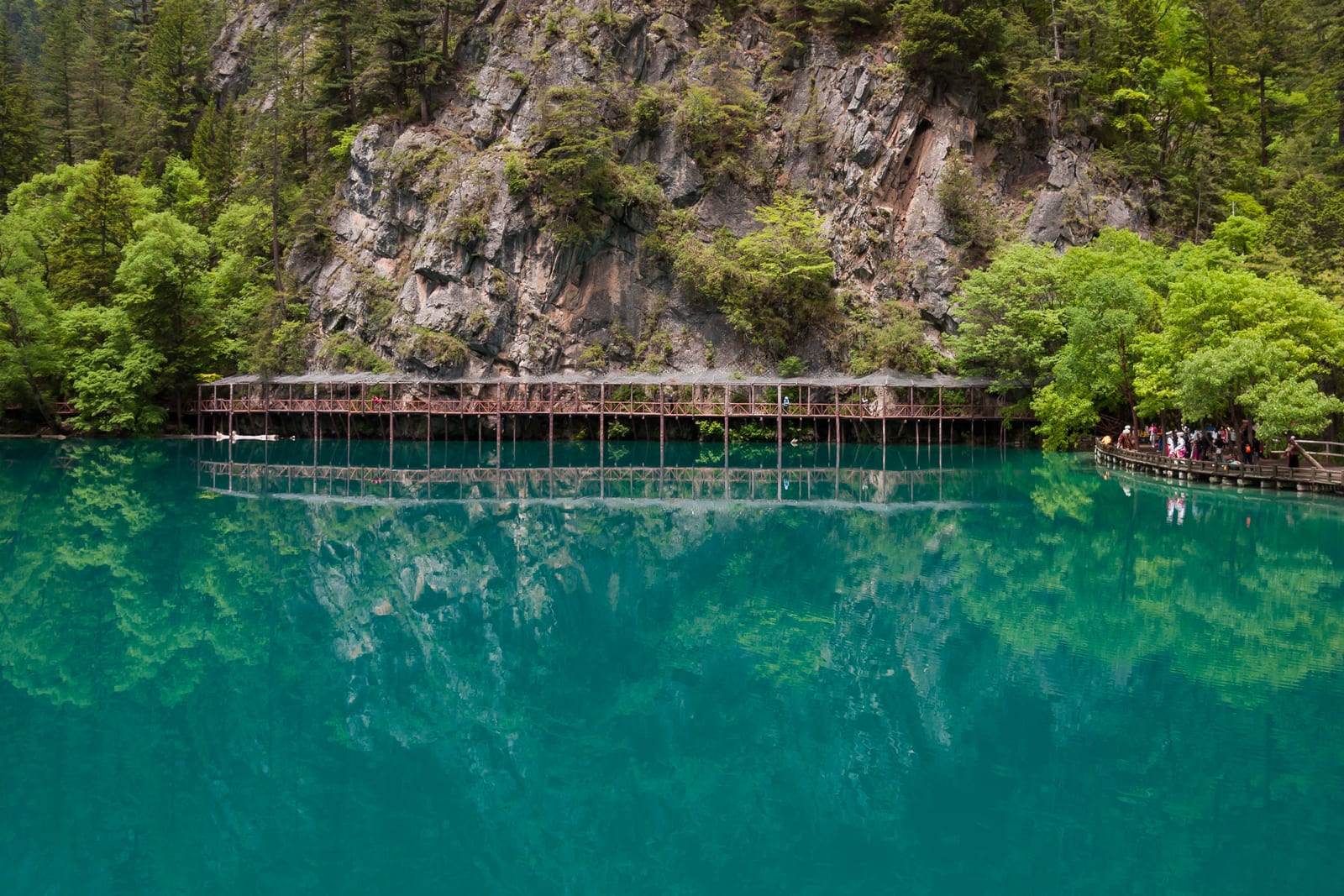
Jiuzhaigou is built around alpine lakes, waterfalls, forest colour and travertine scenery. The visit depends on managed shuttle buses and boardwalks; it is not an unrestricted hiking area.
- Confirm the real-name reservation and entry window before committing to non-refundable lodging.
- Use the same-day shuttle pattern to connect the open parts of Rize, Zechawa and Shuzheng valleys.
- A slower second day can reduce transfers and leave room for weather, but only if the current ticket and entry arrangements permit it.
- Slow down on wet boardwalks and protect cameras from waterfall spray.
Huanglong
Huanglong combines travertine pools, alpine boardwalks and substantial elevation. A cableway can reduce part of the climb, but it does not remove all walking or altitude exposure.
- A cableway ascent followed by a walk down is not the default easy option. Check same-day cableway operation, the length and gradient of the descent, altitude response and exit points. If any condition is unsuitable, use a shorter available return plan or reduce the visit.
- Walk slowly, avoid racing the group and stop ascending if symptoms appear.
- Oxygen is not a reason to continue higher or delay descent and medical help. Follow on-site medical guidance.
- Combining Huanglong and a full Jiuzhaigou visit on the same day is demanding; groups with children, older adults or uncertain altitude tolerance should separate them.
Mount Siguniang
Mount Siguniang has three distinct visitor areas. Shuangqiao Valley is generally the most straightforward sightseeing choice. Changping Valley suits a longer valley walk. Haizi Valley and mountaineering routes require more fitness, equipment and weather judgment.
- Do not treat unregistered climbs, long backcountry routes or wild camping as ordinary sightseeing.
- Carry rain protection, warm layers, sun protection, water and food for valley walks.
- Shorten the day when fog, rain or snow makes the return uncertain.
- Respect protected-area boundaries and keep distance from wildlife.
Ruoergai, Hongyuan and the Yellow River wetlands
This corridor is about broad grasslands, wetlands, Flower Lake, the bends of the Yellow River and Tibetan communities. Open views can hide long distances, cold wind and a slow return after sunset.
- Buy entry only through the current official or on-site channel.
- Park only where permitted; do not drive onto grassland, wetland or herding tracks.
- Watch birds from a distance and do not use drones where they disturb wildlife or conflict with local rules.
- Arrange the return before sunset viewpoints become cold and dark.
Dagu Glacier and Heishui
Dagu Glacier combines a cableway, high-altitude scenery and seasonal forest colour around Heishui. Wind, temperature and personal response at the upper station matter more than completing a checklist. Roads around Heishui have many bends; avoid an unnecessary night drive in rain or snow.
Wenchuan, Li County, Mao County and Qiang villages
This lower-elevation corridor can combine Qiang villages, earthquake memorial sites, Min River valleys, Bipenggou and local food. At Taoping Qiang Village, Yingxiu, Luobozhai and other communities, distinguish public visitor areas from homes, ritual spaces and private courtyards.
Barkam and Aba County
Barkam works for Zhuokeji and Jiarong Tibetan communities as well as an urban base. Aba County adds monasteries, grassland and Tibetan culture. Read local signs before entering religious spaces, and follow guidance on walking direction, photography, clothing and noise.
5. Itinerary Templates
Four days: Jiuzhaigou and Huanglong
Day 1: Reach the Jiuzhaigou area. Rest after the transfer and reconfirm the next day's reservation, entry time, shuttle arrangement and weather. Keep dinner light and avoid alcohol before a high-altitude day.
Day 2: Jiuzhaigou. Follow the current shuttle plan and open boardwalks. Return to the lodging area rather than adding a late mountain-road transfer.
Day 3: Huanglong. Recheck cableway, trail, weather and transport before departure. Reduce the upper section if altitude response or the return becomes uncertain. Stay around Songpan, Chuanzhusi or the Jiuzhaigou corridor according to the verified onward route.
Day 4: Return. Add a short Songpan stop only if road conditions and departure timing leave a safe buffer. In rain, snow or traffic control, protect the return rather than adding another attraction.
Three days: Mount Siguniang
Use the first day to reach the town and adjust to the elevation, the second for Shuangqiao Valley, and the third for a short Changping Valley walk or an early return. Haizi Valley and mountaineering routes are not default additions to this sightseeing plan.
Four days: Ruoergai grasslands
Split Hongyuan, Ruoergai, Flower Lake and the Yellow River viewpoint across realistic driving days. Add the Langmusi direction only when the current road and return plan support it. Keep night driving out of the schedule.
Two days: Wenchuan, Li County or Mao County
This is the more practical short route. Choose one cluster each day: Yingxiu or a Wenchuan village, then Taoping Qiang Village, Bipenggou or Mao County. Do not combine every county merely because the map looks compact.
6. Transport and Where to Stay
Getting around
Build the approach from the transport chain you can verify for the actual date. Mountain transfers may involve an authorised coach, regular passenger service, a properly licensed charter or a self-drive route. For a charter, confirm the vehicle, insurance, driver rest, pickup point, route-change terms and payment record. For self-driving, check expressways, national and provincial roads, construction, mountain passes and weather before each long leg.
Choosing a base
- Jiuzhaigou entrance area: best for an early entry; check heating, hot water, transfer arrangements and cancellation terms.
- Songpan or Chuanzhusi: useful when the verified itinerary connects Jiuzhaigou and Huanglong.
- Mount Siguniang Town: suitable for Shuangqiao or Changping valleys and mountain photography.
- Ruoergai or Hongyuan: useful for grassland and wetland routes; confirm night heating and the return from sunset viewpoints.
- Wenchuan, Li County or Mao County: practical for a shorter family route and Qiang villages.
On busy dates, prefer a cancellable booking and keep the platform record and the property's current contact details.
7. Food and Shopping
Common local meals may include yak, mushroom soup, butter tea, barley foods, Tibetan hotpot, Qiang-style cured meat, potatoes and noodles. At altitude, eat moderately, hydrate and avoid combining alcohol with a higher-elevation visit.
For meat products, mushrooms, medicinal products, silverwork or jewellery, check the displayed price, origin, weight and receipt. Do not rely on health claims. Keep electronic records for lodging, meals, charters and substantial purchases, and understand refund, deposit and delivery terms before paying.
8. Safety and Respectful Travel
- Descend or seek help when altitude symptoms worsen; missing a viewpoint is safer than forcing the route.
- Change plans immediately when rain, snow, fog, rockfall or traffic control makes a mountain road uncertain.
- Do not drive off-road on grassland or wetland, and do not chase livestock or wildlife.
- Read etiquette guidance around monasteries, prayer flags, prayer wheels and ritual spaces.
- Stay behind barriers on boardwalks, waterfalls, lakeshores, snow areas and viewpoints.
- Keep evidence of reservations, lodging, charters, meals and purchases until every deposit or refund is settled.
Aba is rewarding because its landscapes and cultures change from one corridor to the next. A good trip is not the one with the most pins. It is the one whose reservations, roads, weather, altitude and ecological boundaries have been checked before each major move.